Weather Satellite
Weather observations from satellites are becoming indispensable for generating warnings and other information that supports our sustainable social and economic well-being.
BMKG uses weather satellites to detect the development and movement of storm systems and cloud patterns, as well as other phenomena such as volcanic ash, forest fires, smoke, aerosols and other objects in the atmosphere. Geostationary weather satellites such as Himawari-9 have the unique ability to provide repeated real-time images of 36,000 km above the earths surface every 10 minutes.
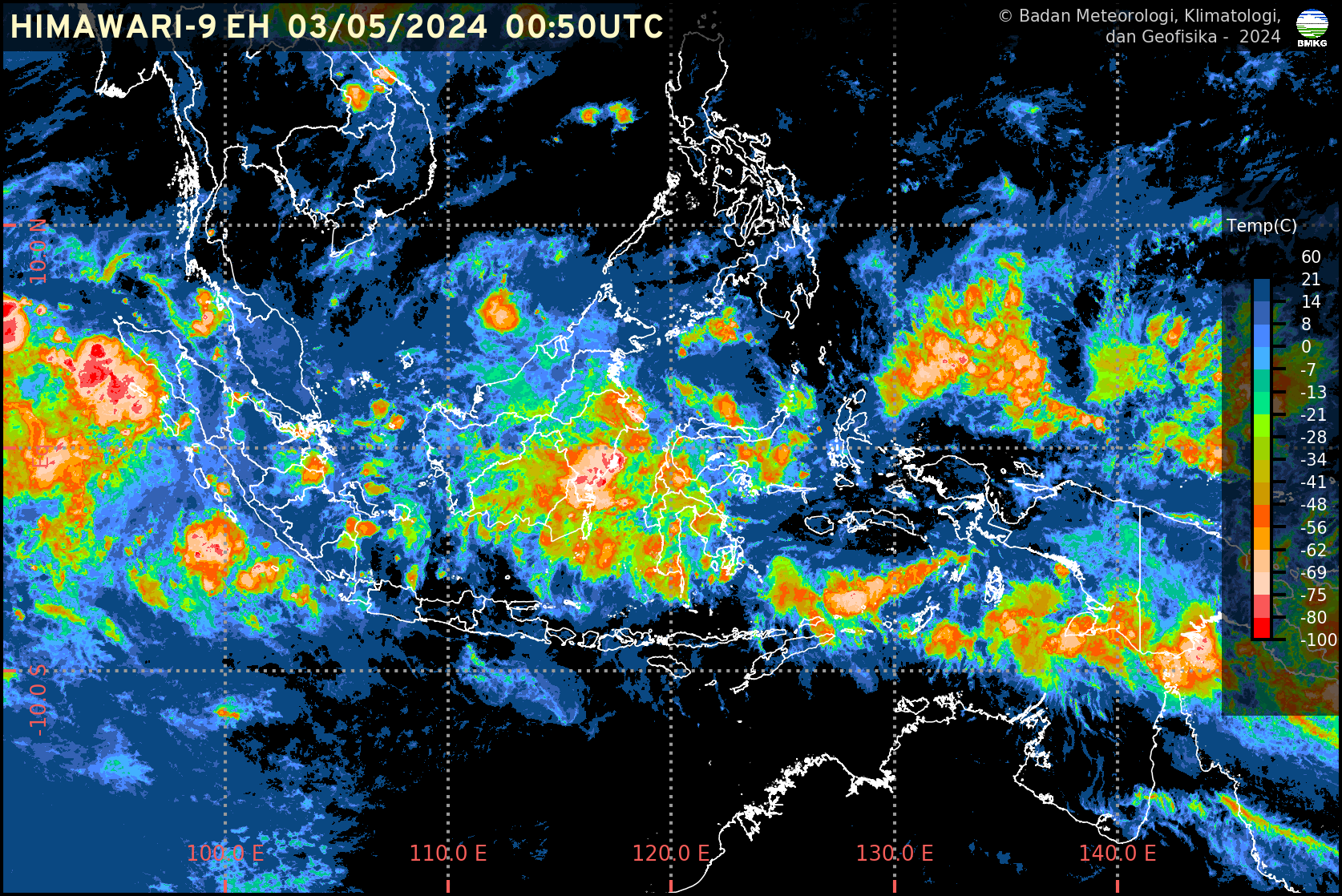
IR Enhanced
The Himawari-9 EH product shows the cloud top temperature obtained from radiation observations at a wavelength of 10.4 micrometers which is then classified with a certain coloring, where the black or blue color indicates there is not a lot of cloud formation, while the colder the cloud top temperature, the color is closer to orange. to red, which indicates significant cloud growth and the possibility of Cumulonimbus clouds forming.
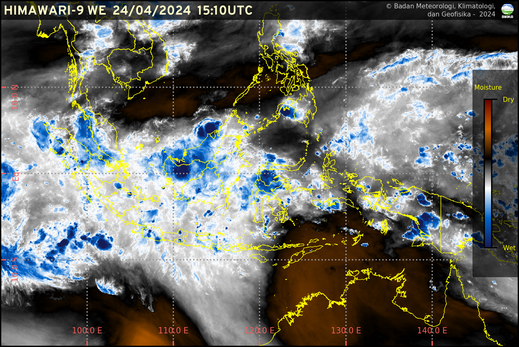
WV Enhanced
The Himawari-9 WE product displays atmospheric humidity conditions in the middle to upper layers obtained from infrared radiation at a wavelength of 6.2 micrometers. This product can indicate air humidity conditions as a cloud formation material, where the brown area indicates dry conditions and blue indicates wet conditions. This product is used to observe the movement of dry air masses from the Australian continent in the dry season.
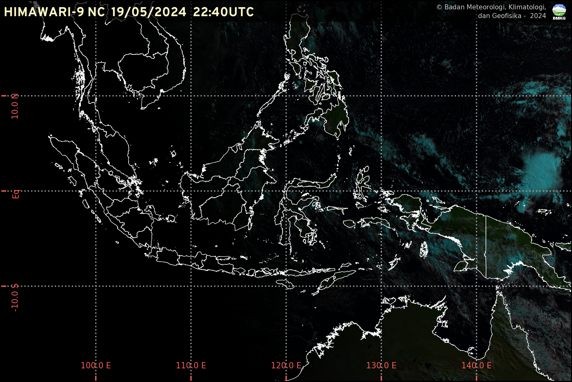
RGB Natural Color
The Himawari-9 NC product uses the RGB (Red Green Blue) method where several bands from satellite data are combined to obtain clearer color identification. This product is used to observe convective processes, cloud thickness, and cloud microphysics. This product uses the visible band emitted by the sun, so this product is only available from morning to evening.

Kantor Pusat Jl. Angkasa I No.2 Kemayoran, Jakarta Pusat, DKI
Jakarta 10610